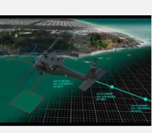
The leading manufacturer of satellite images Maxar is working on a new 3D mapping technology that will provide accurate navigation by correlating sensor data with accurate 3D- a map of the entire planet Earth.
It is noted that the new Pinpoint tool will use a 3D representation of the Earth to aid aircraft in navigation, which could become an alternative to GPS, which is subject to jamming.
Maxar plans to complete several pilot programs and make the tool widely available next year.
«I think in the next few years we will see a shift away from absolute of the GPS navigation system to a more reference navigation system, similar to the one used by sailors when navigating by the stars», — Maxar chief product officer Peter Vilchynsk stressed.
200% Deposit Bonus up to €3,000 180% First Deposit Bonus up to $20,000
The new technology is reportedly based on the company's Precision3D Registration (P3DR) system, which is a stand-alone software solution for automatic geo-registration of images on the globe in 3D with a resolution of 50 cm or better and an accuracy of 3 m in all measurements.
«Our accuracy is the same in Pyongyang, London and New York», — the company noted.
It is known that the system automatically correlates images with a highly accurate 3D map of the planet in real time without human intervention and can work with video in real time or individual images.
In cases when the image quality is poor (for example, due to a large number of clouds or other obstacles), the relationship with the 3D model may be "suboptimal", and the system includes " measure of confidence», which indicates accuracy.

